Today we make many carnival organizations and outdoor events happy with our expectation. The storm (Ellen) no longer applies to our country. When it comes to the wind, what can we expect this weekend? Here I will discuss one of the cases that we will have to deal with, especially towards the carnival. Below you can read an answer I sent to one of our customers. This gives you a bit of an estimate of how we approach our customers.
---
Would you like to tell us how things are going on Sunday and Monday?
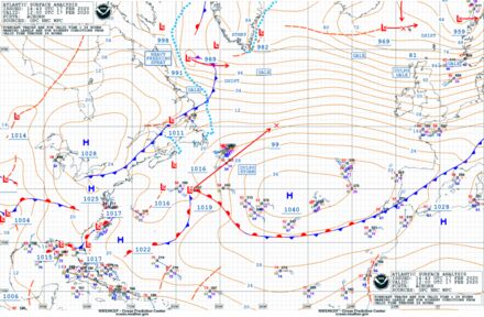
As it stands now, it all seems to be going well. Where the models previously expected a serious storm, the chance of an actual "storm" now seems limited to the far west of the Netherlands. On the coast it can come to wind force 9 for a short while (gale force), and if it stays here for an hour at wind force 9, we are talking about an official storm, but this chance is relatively small. Deeper inland there will be no storm anyway, and it will be limited to gusts of 75 to 80 km / h. (wind force 6/7) In the east of the Netherlands and Belgium there is a strong wind, but there is absolutely no mention of a storm. (force 5) There will be a lot of rain in the coming days.
Does Storm Ellen become a storm like Ciara and Dennis? At the sea it may briefly be a repetition of Storm Dennis, but in storm Ciara Ellen does not come close.
What are the chances of a storm?
The probability has decreased significantly, from 75% to 30%. We expect that gusts of wind can occur at sea with gale force, but it is unlikely that there will be an official storm. The low-pressure area has not explored sufficiently for this, which is classic in a storm development.
Is damage expected again?
Yes, although the storm will be less powerful, damage is expected. Also mainly due to the previous storms that have made trees, for example, less stable in the ground. This may be the last push they need. We do, however, expect less storm damage than at Storm Dennis and Ciara.
When a storm is given a name, aren't we talking about a serious / violent storm?
Yes, that is correct, but that does not always apply to the Netherlands. A storm with a name can also cause very heavy gusts of wind above the British Isles, while the storm in the Netherlands is not too bad. Then such a storm is given a name.
Do I have to take precautions for Storm Ellen?
For your carnival association, the wind is below wind force 6 (but please note, the weather maps can still change in a negative sense). Limit yourself in these items or install an extra fuse.
Can we ride out with this wind?
Maybe, I just want to keep an eye on the gusts of wind. These still encounter your area against the maximum wind parameter of 6BFT. Do not underestimate this storm, because gusts of 75kmph can also hit very hard and floats are simply less resistant to the wind, can fall over on the public, which can cause panic.
How much wind is expected for our environment. ** This is the most frequently asked question in the last 24 hours. **
Unfortunately, we cannot predict this with any certainty at this time. The wind is the most difficult weather factor to map during a storm depression. We do see a downward trend, but I can only map this out the night before. The best is still Sunday morning. I will call you as early as possible. So just hold your breath!
---
What we often hear as a meteorologist at an event is that they feel abandoned by their previous weatherman. Purely because of the fact that people provide too little information about where they are and that they often come up with cut and paste information. This is of no use to you as an organization. Our job is to take your hands off your hair when it comes to important weather information. You will ALWAYS receive a comprehensive and understandable answer to all these (and other) questions. In an emergency situation we answer three questions. What's coming? How long do I still have time? And how bad is it? After that, it is up to you to make a solid decision together with us and the safety region during COPI. We take into account your location, placement of objects, size of the festival, the number of temporary wind-sensitive objects and the location of iron objects.
nl
Vandaag maken we veel carnavalsorganisaties en buitenevenementen blij met onze verwachting. De storm (Ellen) is voor ons land niet meer van toepassing. Als het gaat om de wind, wat kunnen we dan wel verwachten aankomend weekend? Ik behandel hier een van de casussen waarmee we, vooral richting het carnaval, mee te maken krijgen. Hieronder leest u een antwoord die ik heb gestuurd naar een van onze klanten. Zo krijgt u een beetje een inschatting hoe wij onze klanten benaderen.
---
Willen jullie ons vertellen hoe het er zondag en maandag voorstaat?
Zoals het er nu voor staat, lijkt het allemaal reuze mee te gaan vallen. Waar eerder de modellen nog echt wel een serieuze storm verwachtte, lijkt de kans op daadwerkelijke "storm" nu beperkt tot het uiterste westen van Nederland. Aan de kust kan het nog wel heel even tot windkracht 9 komen, (stormkracht), en als het hier een uur windkracht 9 blijft, spreken we over een officiële storm, maar deze kans is relatief klein. Dieper landinwaarts komt het sowieso niet tot storm, en blijft het beperkt bij windstoten van 75 tot 80km/u. (windkracht 6/7) In het oosten van Nederland en België waait het stevig, maar daar is absoluut geen spraken van storm. (windkracht 5) Wel valt er veel regen de aankomende dagen.
Wordt Storm Ellen een storm zoals Ciara en Dennis ? Aan zee kan het wel kortstondig een herhaling worden van Storm Dennis, maar bij storm Ciara komt Ellen niet in de buurt.
Hoe groot is de kans dat het tot storm komt?
De kans is flink gedaald, van 75% naar 30%. Wij verwachten dat er aan zee windstoten kunnen voorkomen met stormkracht, maar tot een officiële storm gaat het waarschijnlijk niet komen. Daarvoor heeft zich het lagedrukgebied te weinig uitgediept wat klassiek is bij een stormontwikkeling.
Wordt er opnieuw schade verwacht?
Ja, ondanks dat de storm minder krachtig zal zijn, wordt er wel schade verwacht. Ook vooral door de vorige stormen die er voor hebben gezorgd dat bijvoorbeeld bomen minder stabiel in de grond staan. Dit kan het laatste duwtje zijn die ze nodig hebben. Wel verwachten wij minder stormschade dan bij Storm Dennis en Ciara.
Als een storm een naam krijgt, spreken we toch over een serieuze / heftige storm?
Ja dat klopt, maar dat is niet altijd ook voor Nederland van toepassing. Een storm met een naam kan ook bijvoorbeeld boven de Britse eilanden zorgen voor zeer zware windstoten, terwijl de storm in Nederland mee valt. Dan krijgt zo'n storm toch een naam.
Moet ik voor storm Ellen voorzorgmaatregelen nemen?
Voor jullie carnavalsvereniging is de wind onder windkracht 6 (maar let wel, de weerkaarten kunnen nog in negatieve zin veranderen) Denk ook gelijk aan je afhekstructuur, , layherboxen, beachvlaggen en andere windgevoelige objecten die ook nadelig op windstoten kunnen uitvallen. Beperk je in deze items of leg een extra zekering aan.
Kunnen wij uitrijden met deze wind?
Misschien, ik wil nog even de windstoten in de gaten houden. Deze komen jullie gebied toch nog tegen de maximale windparameter van 6BFT. Onderschat deze storm dan ook niet, want ook windstoten van 75kmph kunnen erg hard aankomen en praalwagens zijn nou eenmaal slechter bestand tegen de wind, kunnen omvallen op publiek waardoor er paniek kan ontstaan.
Hoeveel wind wordt er verwacht voor onze omgeving. **Dit is de meest gestelde vraag van de afgelopen 24 uur.**
Helaas kunnen wij dit op dit moment met geen enkele zekerheid voorspellen. De wind is de moeilijkste in kaart te brengen weersfactor tijdens een stormdepressie. Wel zien we een dalende trend, maar ik kan dit pas de avond van tevoren in kaart brengen. Het beste is nog zondagochtend. Ik zal jullie zo vroeg mogelijk bellen. Dus nog even de adem inhouden!
---
Wat wij veel horen als weerkundige op een evenement is dat men zich in de steek gelaten voelt door hun vorige weerman. Puur om het feit dat men te weinig informatie geeft over de plek waar ze zijn en te vaak met knip en plak informatie komen. Daar heb je als organisatie helemaal niets aan. Ons werk is jouw handen uit het haar halen als het gaat om belangrijke informatie over het weer. Op al deze (en andere) vragen krijgt u van ons AL-TIJD een uitgebreid en begrijpelijk antwoord. Bij een noodweersituatie geven we antwoord drie vragen. Wat komt er aan? Hoelang heb ik nog de tijd? En hoe erg is het? Daarna is het aan u om samen met ons en de veiligheidsregio tijdens COPI een gedegen beslissing te nemen. Wij houden rekening met uw locatie, plaatsing van objecten, grootte van het festival, het aantal in tijdelijke windgevoelige objecten en de locatie van ijzeren objecten.